Half Dome, Yosemite National Park
Everything you need to know before you climb Half Dome in Yosemite National Park.
- The cables are up from late May or early June through Columbus Day weekend in October, making that the only window to summit. Shoulder season dates in late May, early June, September, and October see fewer hikers and are worth targeting if you can swing it.
- The trail from Yosemite Valley covers 14 to 16 miles and gains 4,800 feet of elevation, passing Vernal Fall and Nevada Fall before reaching the cables on the granite dome. Plan on 10 to 12 hours to complete the hike and back.
- Two steel cables let hikers climb the final 400 feet to the summit, with wooden supports every 10 to 20 feet to rest and maintain balance. Bring gloves with a solid grip and shoes with sticky soles for this section.
- The cables go up each spring and come down each fall, typically from the Friday before Memorial Day through the Tuesday after Columbus Day, though exact dates depend on conditions. A permit is required 24 hours a day, seven days a week to ascend the sub-dome or Half Dome cables. Permits are distributed through a lottery via Recreation.gov, with a preseason application period running March 1 through March 31 and daily lotteries during the hiking season.
- The closest parking area to the trailhead is near Curry Village, but it fills up fast since most Half Dome hikers try to park there early. You can also park in the eastern part of the valley and take one of Yosemite's free shuttles to the trailhead. Avoid Half Dome on days with thunder clouds in the area, and skip stormy days altogether since even rain without lightning makes the granite on the cable route dangerously slick.
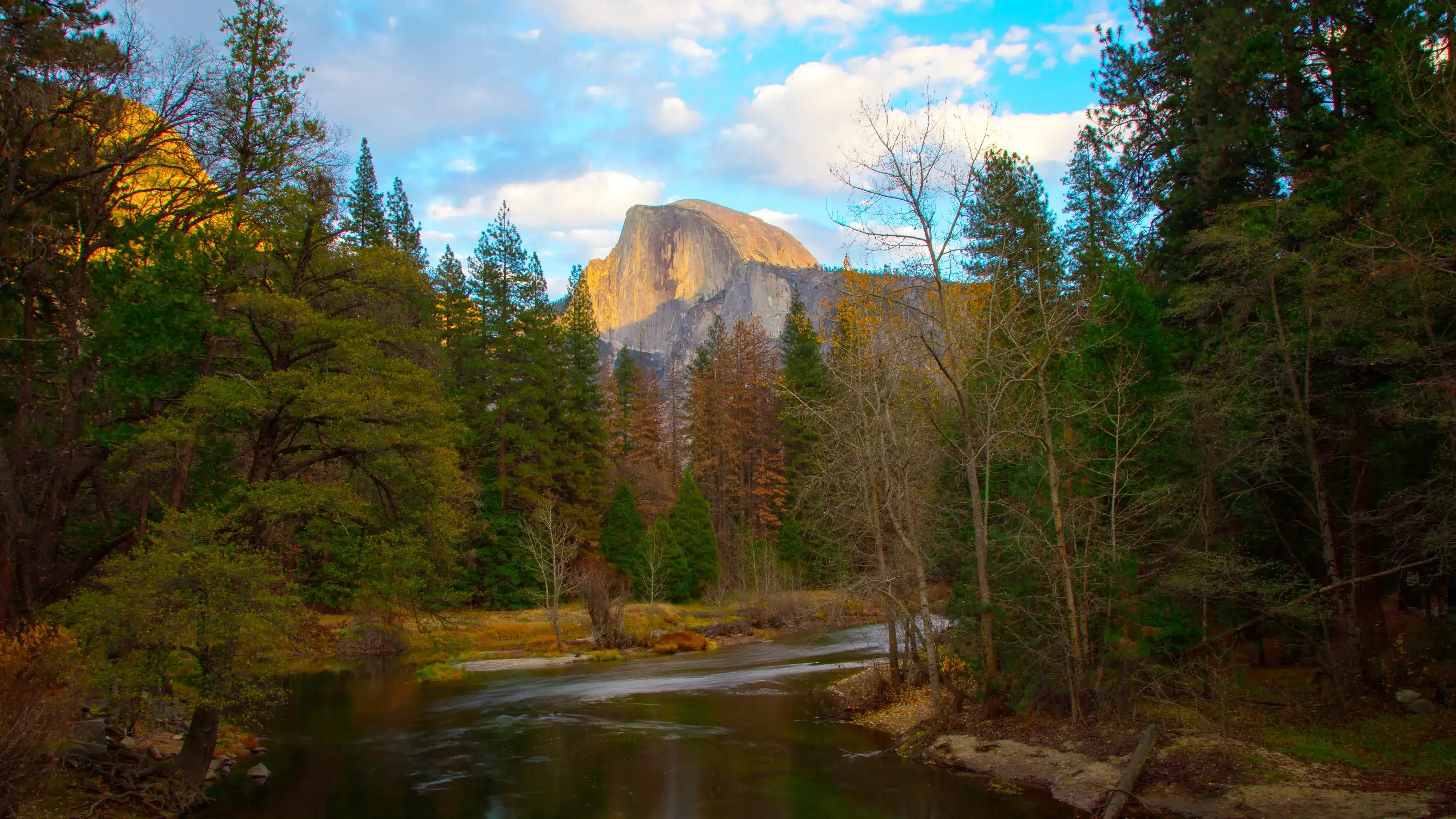
From the riverbank near Housekeeping Beach, you look east across the Merced River and Half Dome fills the frame. The granite face reads as a palette of warm grays and pale gold, with dark vertical streaks tracing where water drains down the rock over centuries. The valley floor around you sits at around 4,000 feet, and the walls on either side rise another 3,000 to 4,000 feet of near-vertical stone above the trees.
The forest between you and the dome is a mix of ponderosa pines, incense cedars, and California black oaks. The incense cedars grow dense and columnar near the river, their reddish-brown bark peeling in long strips and their flat scale-like foliage catching the light in layers. The black oaks grow broader and more open-crowned, dropping their lobed leaves yellow-brown in October. In spring and early summer, the Merced runs cold and fast here, carrying snowmelt from the high Sierra and cutting a wide, clear channel through sand and river cobble.
Wildlife is active at both ends of the day. Mule deer graze the meadow edges in low light, and Steller's jays move through the canopy in short, direct flights. Black bears are a real presence in the valley, particularly in late summer when they range widely in search of food before winter. Early morning is when this place is quietest and the light hits the dome most directly, turning the upper granite a warm amber while the valley below is still in shadow.
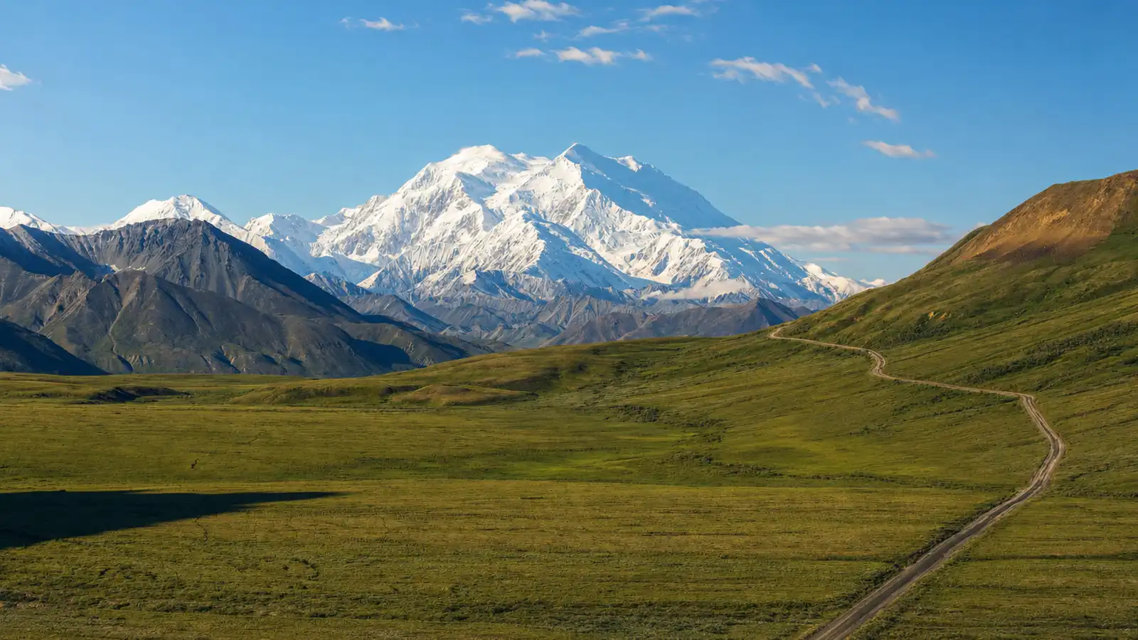
Half Dome itself rises to about 8,800 feet. The hike to the summit covers roughly 16 to 17 miles round trip from the valley floor and gains around 4,800 feet of elevation. This guide covers everything you need to plan and complete that hike, including the permit system, route options, gear, and conditions across the season.
Visiting Half Dome in Yosemite National Park
Getting there
The most popular day hike route starts at the Happy Isles shuttle stop in Yosemite Valley. The closest parking is Yosemite Valley Trailhead Parking, located just past Half Dome Village. From there it is a half mile walk down a service road to the Happy Isles Bridge and the start of the hike.
For early arrivals before the 7:00 AM shuttle service begins, plan to walk the trail next to the road from either of the parking areas to reach the trailhead. The cable route hike runs from the valley floor to the top of the dome in 8.2 miles via the Mist Trail with 4,800 feet of elevation gain. A permit is required to access the cables and you can enter the lottery through the NPS recreation system.
When to go and when to be there
Late spring through early fall is the main window when the cables are installed and the trails are generally clear. Shoulder seasons like spring and fall offer quieter experiences and pleasant weather, and in spring the waterfalls around Yosemite Valley are usually at their peak.
For lighting, the two reliable spots to catch Half Dome are from Washburn Point along Glacier Point Road around sunrise and from Cook Meadow around sunset. The first light often hits Half Dome first, turning the granite a warm golden color while the valley below slowly fills with light. If you are on the summit or heading up the cables, an early start also keeps you ahead of afternoon thunderstorms that can roll in quickly from the Sierra.
Small details worth pausing for
Three things to look for along the way:
Lichen stripes on the sheer face. Colonies of brown black lichens form dark vertical drip like stripes along drainage tracks in the rock face. These streaks are what gave Half Dome one of its original Ahwahnechee names.
Exfoliation on the dome surface. The summit of Half Dome was never overtopped by glaciers, so its rounded shape results from a different kind of erosion called exfoliation, the process by which slabs of rock break and peel away along curving parallel fractures similar to the skins of an onion. You can see this layering clearly as you climb the sub dome.
Black bears and mule deer on the trail. Early morning and evening offer the best opportunities to spot wildlife including black bears and deer. Plant life varies significantly with elevation and exposure as well, so pay attention to how the forest shifts from mixed conifers in the valley to sparse pine and open granite as you gain elevation.
Insider Tips
Skip Glacier Point and walk to Sentinel Dome
Glacier Point draws crowds for good reason, but Sentinel Dome gives you a 360-degree view of Yosemite Valley with far fewer people sharing the space. From the summit you can see Half Dome, Yosemite Falls, and the full sweep of the high Sierra in one unobstructed look.
The hike is a 2.1 mile round trip, starting from the same trailhead as Taft Point off Glacier Point Road. Come at sunset and the granite catches warm light across the dome face.
What to wear on the Half Dome cables
Sturdy hiking boots with solid ankle support and grip are essential for the granite, especially on the cable section where the rock gets steep and slick. Sneakers won't hold traction on a 45 degree pitch.
Bring a pair of nitrile work gloves for the cables. The steel will tear up bare hands on the 400 vertical foot climb, and rangers no longer allow spare gloves to be left at the base of the subdome. Pack your own and keep them in your bag until you need them. Layer up at the trailhead since temperatures shift dramatically from the valley floor to the fully exposed summit.
Stop in Groveland on the drive from San Francisco
If you're coming in from the Bay Area on Highway 120, Iron Door Saloon in Groveland is worth a stop about 25 miles before the park entrance. It's widely considered the oldest continuously operating saloon in California and sits right on Main Street in a Gold Rush era building built from local granite.
Grab a burger and a beer before you make your final push into the park. The staff knows the area well and can point you toward trails and campgrounds you won't find in the guidebooks.
Nearby Hikes
Trails worth your time when you're in the area.
Half Dome via Mist Trail
This is the signature hike of Yosemite Valley, climbing from Happy Isles past Vernal Fall and Nevada Fall before ascending the exposed granite subdome and the steel cable route to the summit at about 8,800 feet. The route follows the Mist Trail on the way up and many hikers return via the John Muir Trail for a slightly longer but more gradual descent. A permit is required to use the cables, which are typically in place from late May through mid-October. Plan for 10 to 12 hours on trail.
View on nps.govMist Trail to Nevada Fall
Starting at Happy Isles, this strenuous hike climbs stone steps alongside 317 foot Vernal Fall before continuing to 594 foot Nevada Fall. The Mist Trail reaches the top of Nevada Fall in 5.4 miles round trip with 2,000 feet of elevation gain. Many hikers return the same way or make a longer loop with the John Muir Trail for different views of Liberty Cap and both falls. No permit is required.
View on nps.govClouds Rest via Sunrise Lakes Trailhead
Starting off Tioga Road near Tenaya Lake, this trail climbs through mixed terrain to the 9,926-foot summit of Clouds Rest, the largest exposed granite surface in Yosemite. The final quarter mile traverses a narrow ridge with steep drop-offs on both sides and delivers a 360-degree view that takes in Half Dome, Yosemite Valley, and the surrounding high country peaks. No summit permit is required, making this a good alternative when Half Dome permits are unavailable. Tioga Road closes in winter, typically limiting access to late May through October.
View on yosemitehikes.comPanorama Trail: Glacier Point to Yosemite Valley
This one way hike starts at Glacier Point and passes Illilouette Fall, Nevada Fall, and Vernal Fall before ending in Yosemite Valley. It covers about 8.2 miles and includes roughly 800 feet of climbing before the final descent. Arrange your own transportation because there is no shuttle back to Glacier Point.
View on nps.govFour Mile Trail to Glacier Point
Named for its original length before a reroute added extra mileage, this trail climbs steadily from the valley floor to Glacier Point along a series of switchbacks on the south wall of Yosemite Valley. The trail is largely exposed and gains over 3,000 feet, but the views of El Capitan, Yosemite Falls, and Half Dome open up progressively as elevation increases. Many hikers do this as an out and back, or combine it with the Panorama Trail if they have arranged their own transportation between trailheads. Start early in summer to avoid heat on the unshaded upper sections.
View on nps.govYosemite National Park Hat
100% of the profit from every hat goes straight to the National Parks. Not a round-up. Not a percentage. The whole margin.
Shop this hat
Protecting Yosemite
Yosemite's conservation outlook is rated "good with some concerns" by the IUCN, but real pressure exists on the ground. The Half Dome Corridor is the most popular hiking terrain in the park, and informal "social" trails cut across sensitive habitat while failing trail tread creates safety hazards. The park typically draws about 4 million visitors a year, and that congestion raises real questions about long-term sustainability.
The park's protected landscape supports more than 400 kinds of mammals, birds, amphibians, fish, and reptiles and provides a haven for threatened and endangered species. Keeping that web intact takes active, ongoing work. Reliable long-term funding from government remains a challenge, which means the parks depend on people outside the agency to fill the gap.
That's where Rainier Hat Co. comes in. We don't just sell hats; we act as a direct funding vehicle for the parks. Every dollar of profit from the Yosemite National Park Hat goes straight to the National Parks as a 100% profit donation. Buying one isn't about a souvenir to collect dust on a shelf. It's a concrete way to put money toward the trails, habitats, and ecosystems that make a place like Half Dome worth protecting for the people who come after us.