Yaki Point, Grand Canyon National Park
- Yaki Point is closed to private vehicles, so reach it via the free Kaibab/Rim (Orange) Route shuttle from the Grand Canyon Visitor Center, or arrive by bike or on foot along the Rim Trail.
- The overlook faces east, making it one of the South Rim's stronger sunrise spots, with the Desert View Watchtower visible on the horizon and deep color in the canyon walls at both ends of the day.
- September through November offers the best combination of mild weather, thinner crowds, and good light, with spring running a close second.
- From the rim you can trace the South Kaibab Trail corridor, pick out O'Neill Butte and Wotan's Throne, and watch for California Condors riding the canyon thermals on wingspans up to 9 feet wide.
- The South Kaibab Trailhead sits just off Yaki Point Road and gives you direct access into the canyon, with day hike options ranging from the short descent to Ooh Aah Point (0.9 miles one way) to the longer push down to Skeleton Point (3 miles one way).
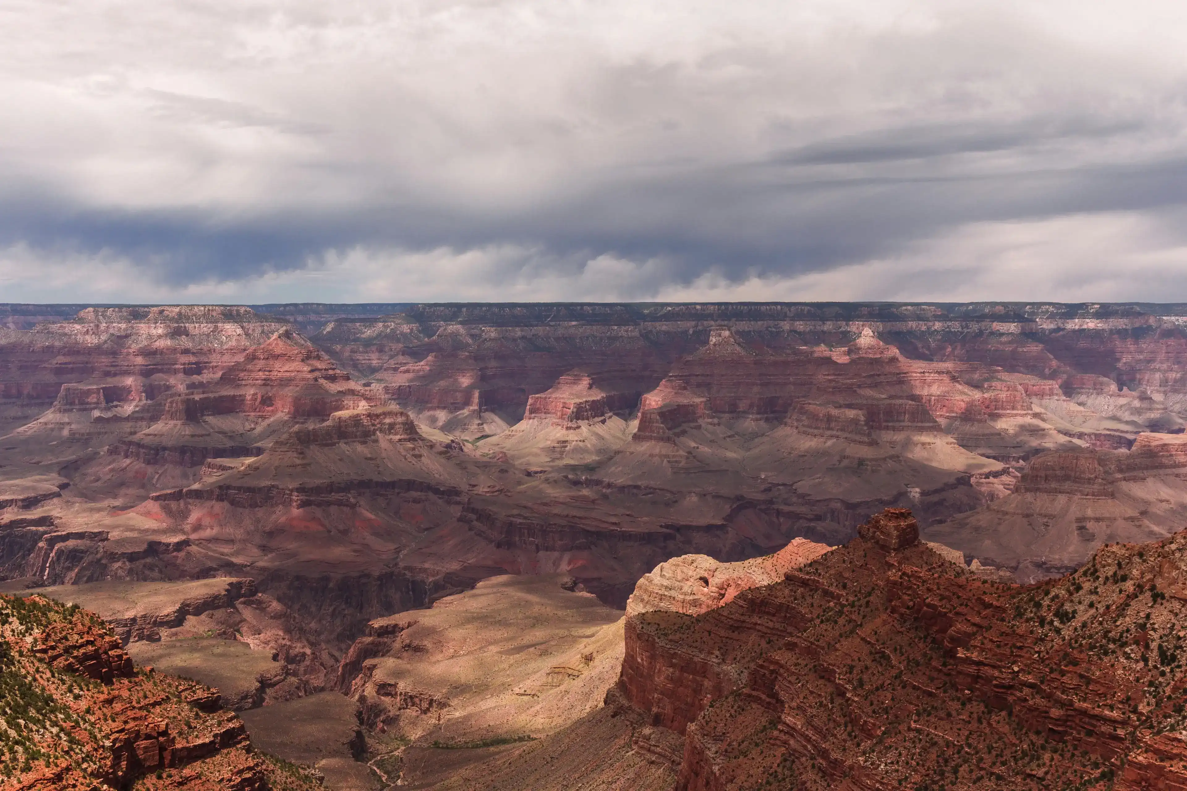
Yaki Point occupies a promontory on the South Rim at 7,262 feet, where the canyon opens broadly to the east. The first thing you notice when you step off the shuttle is the wind moving up through the canyon below you, a near constant presence that carries the dry, resinous smell of pinyon pine and Utah juniper growing along the rim's edge.
The scale takes a moment to register. The canyon averages 4,000 feet deep across its entire 277 miles, reaching 6,000 feet at its deepest point and stretching 18 miles across at its widest. From this promontory, you can trace the Colorado River far below, spot the Desert View Watchtower 22 miles to the east, and watch hikers winding down the South Kaibab Trail.
The wall of rock across from you reads like a cross section of deep time. Red sandstones, gray limestones, and greenish shales each reflect a different ancient environment: seas, deserts, and swamps laid down over hundreds of millions of years. The vivid colors of many of these layers come mainly from small amounts of minerals, most containing iron, which gives the canyon walls their subtle shades of red, yellow, and green. At sunrise, when the light comes in low from the east, the warm tones in the Supai formation and Redwall Limestone intensify before the midday sun flattens everything to pale ochre.
Yaki Point also sits in a productive wildlife corridor. California condors ride the thermal updrafts that push up from the canyon floor, and during fall migration the rim sees thousands of raptors moving through overhead. Mule deer graze along the road to the trailhead at dusk. Because private vehicles are prohibited beyond the gate on Yaki Point Road, visitors arrive by shuttle, bicycle, or on foot, which keeps crowds lighter than at nearby Mather Point and leaves the soundscape largely intact.
Visiting Yaki Point
Getting there
Yaki Point is the only scenic viewpoint on Desert View Drive that is not accessible by private vehicle. Reach it by taking the free Kaibab/Rim Route (Orange) shuttle, departing from the Grand Canyon Visitor Center. The ride takes about 9 minutes, and shuttle frequency changes by season, so check the NPS schedule before you go. You can also arrive by bike or on foot along the Rim Trail. Plan to arrive 45 minutes before sunrise or sunset to secure a good spot and allow time for the short walk from the bus stop.
When to go
The view opens dramatically to the east, making this a premier sunrise location where the Desert View Watchtower appears as a distant silhouette on the horizon. Views are probably better to the east at dawn than they are to the west at dusk, though the fading light of sunset brings out deep, rich colors in the canyon's rock layers that midday light tends to flatten. The best time of year is between September and November, during the shoulder season, which offers favorable weather and good light for both sunrise and sunset. Spring works well too. Midday in summer brings harsh overhead light and frequent afternoon thunderstorms, so plan your timing accordingly.
What to look for
Three details worth slowing down for once you reach the rim:
O'Neill Butte and Wotan's Throne. Notable geological formations from the overlook include the large flat-topped butte known as Wotan's Throne and the distinctive O'Neill Butte. Both are easy to pick out once you know what you're looking for.
The South Kaibab Trail corridor. Looking westward you can trace the end of the Bright Angel Trail, part of the Tonto Trail, and most of the South Kaibab Trail along Cedar Ridge. Watch for hikers working their way down the switchbacks below you.
California Condors. Use binoculars for a chance to spot California condors soaring on canyon thermals. They ride the updrafts with slow, deliberate wingbeats and a wingspan that can reach 9 feet, making them easier to track against open sky than most other birds.
Insider Tips
Walk the rim trail east of the overlook for a cleaner shot
Once you step off the shuttle at Yaki Point, most visitors cluster at the main overlook platform. Walk east along the rim trail for a few minutes and you'll find open promontories where O'Neill Butte and Cedar Ridge fill the foreground without railings or crowds in the frame.
The angle shifts as you move east, pulling Mather Point into the background and giving you a true sense of depth across the canyon layers. Early morning light hits the east facing formations directly from this stretch, so it's worth arriving before the shuttle fills up.
Dress for wind and elevation, not just heat
The rim sits around 7,000 feet and the wind that moves up through the canyon is constant, especially at the exposed promontories at Yaki Point. Pack a windbreaker and layer underneath, even in summer, since temperatures at the rim can run 20 degrees cooler than the inner canyon.
Sturdy trail shoes with grip help on the rocky rim edge, particularly if you're moving off the paved path to find a better vantage point. Sunglasses with UV protection matter here too since the reflected light off the pale canyon walls is intense at midday.
Stop for breakfast at Brandy's in Flagstaff before you head out
Flagstaff sits about 80 miles south of the South Rim and makes a natural launching point for an early morning drive to Yaki Point. Brandy's Restaurant & Bakery at 1500 E Cedar Ave opens at 7 AM and turns out made from scratch pancakes, egg dishes, and a full espresso bar that will carry you through a long morning on the rim.
The drive from Flagstaff on AZ-64 north takes roughly 90 minutes. Leave after breakfast and you can reach the shuttle stop at the Grand Canyon Visitor Center with enough time to catch the first Kaibab/Rim Route bus out to Yaki Point before the light shifts.
Nearby Hikes
Trails worth your time when you're in the area.
South Kaibab Trail to Ooh Aah Point
The trailhead sits on Yaki Point Road, a short walk from the shuttle stop, making this the most direct canyon hike from Yaki Point. The trail drops below the rim through a series of switchbacks and then follows an open ridgeline to Ooh Aah Point, where the canyon wall turns and the eastern corridor opens up in front of you. O'Neill Butte fills the middle distance and Skeleton Point sits beyond. No water is available on the trail, and the climb back out is steeper than it looks on the way down.
View on nps.govSouth Kaibab Trail to Cedar Ridge
Cedar Ridge sits about 1.5 miles below the rim along a ridgeline that keeps you exposed to wide canyon views the entire way. The trail passes Ooh Aah Point before descending further to a broad saddle with vault toilets and a mule hitching post. It's the farthest the NPS recommends pushing in summer heat, and it's the last place with facilities before Skeleton Point. There is no water anywhere on the trail. Carry at least two liters and start early.
View on nps.govSouth Kaibab Trail to Skeleton Point
Skeleton Point is the farthest turnaround the NPS recommends for day hikers on the South Kaibab Trail. At three miles below the rim, the trail arcs around the east side of O'Neill Butte and arrives at a point where a short spur trail to the west offers the first view of the Colorado River. The climb back out gains over 2,000 feet with no water and no shade. Plan for at least four to six hours total and get an early start, especially outside of the cooler months.
View on nps.govBright Angel Trail to 3 Mile Resthouse
The most popular trail on the South Rim starts near Bright Angel Lodge in Grand Canyon Village, about a mile west of Yaki Point via the Rim Trail. Unlike the South Kaibab, Bright Angel runs through a shaded side canyon along a fault, with seasonal water stops at the 1.5 Mile and 3 Mile Resthouses. The 3 Mile Resthouse makes a solid turnaround for a full day hike. The trail is well maintained, roughly four feet wide throughout, and grades at around 10 percent on average.
View on nps.govRim Trail: South Kaibab Trailhead to Mather Point
The paved Rim Trail connects the South Kaibab Trailhead at Yaki Point Road west to Mather Point and beyond to Grand Canyon Village. Walking it from the shuttle stop at the South Kaibab Trailhead to Mather Point covers about 2.2 miles each way along the canyon edge, with open views the entire route. The trail is mostly flat and accessible, passing Pipe Creek Vista along the way. The free Orange Route shuttle runs the same corridor if you want a one way walk back.
View on nps.govGrand Canyon National Park Hat
100% of the profit from every hat goes straight to the National Parks. Not a round-up. Not a percentage. The whole margin.
Shop this hat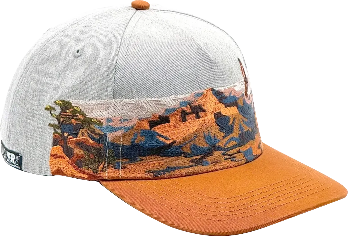
Protecting Grand Canyon
Grand Canyon National Park sits within one of the most ecologically complex landscapes in North America. The park functions as an ecological refuge, sheltering remnants of rare ecosystems alongside over 1,500 plant species, 355 bird species, 89 mammal species, and numerous threatened or endangered animals found nowhere else on earth.
At Yaki Point specifically, HawkWatch International has monitored fall raptor migration here since 1997, work that led to Yaki and Lipan Points being designated as Important Bird Areas in 2002, a recognition later extended to the entire park in 2014. Because raptors sit at the top of the food chain, they respond quickly to environmental shifts, making them useful indicators of ecosystem health.
The park faces real pressure. The lands and watershed surrounding the park are threatened by increased development, logging, and a resurgence of uranium mining, each of which poses serious danger to tribal communities, drinking water, and wildlife. Lack of funding could threaten historic structures, conservation programs, visitor services, and archeological sites in coming years. Places like Yaki Point exist because people fought to protect them, and keeping them intact requires ongoing investment.
That's where Rainier Hat Co. comes in. We don't just make hats for people who love the outdoors. We operate as a funding vehicle for the parks themselves, donating 100% of profits directly to the National Parks. When you pick up the Grand Canyon National Park Hat, you're not just taking home a piece of gear from the trip. You're putting money back into the landscape that made the trip worth taking.